Setting Bird's eye view
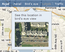
To set bird's eye view when viewing a map, select Bird's Eye as the type of view from the Live Search Maps toolbar. Note that this map view may not be available for all map areas.

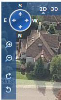
 Another useful feature of Live Search Maps is the ability to view a bird's eye image from 4 different directions: North, South, East, and West. The compass control allows you to control the bird's eye view. Clicking the E, S, W, or N button determines which directional image is displayed. Clicking the + and - buttons determines the zoom level for the image. Clicking the clockwise and counter-clockwise buttons rotates the image.
Here's how Redmond High School looks like from the 4 different directional bird's eye views:

Give it a try!


No comments:
Post a Comment